
Geographic Data is not just about SIG
In 2024, geographic data has become an indispensable tool across various industries, revolutionizing how we interact with the physical world. From the press to archaeology, public infrastructure, museography, and cultural mediation, the applications of geographical data are vast and ever-evolving. This article delves into the significance of geographic data, the advancements in data gathering technologies, and the implications of its use, highlighting the crucial role of Geographic Information Systems (GIS) and Digital Assets Management (DAM) systems in shaping our future.
Geographical data across the industries
Press
In journalism, geographic data aids in visual storytelling, helping to contextualize news events. Reporters use it to analyze and communicate complex stories, such as
Archaeologists leverage geographic data for site discovery and excavation planning. Technologies like LiDAR and photogrammetry
Archaeology
Public Infrastructure
In public infrastructure projects, geographic data ensures efficient planning and management. It helps in routing, zoning, and environmental impact assessment, leading to more sustainable development. It is no surprise that historical partners of survey operations such as
Museums use geographic data to trace the origins of artifacts and create immersive, interactive exhibits. This technology bridges the gap between historical artifacts and modern audiences, enhancing educational experiences.
Museography and Cultural Mediation
...not to mention the usual driving assistants and itinerary calculators, and other tools so often used we take them for granted.
2021 EU Report: Integration of Geographic and Statistical data for better policy making
Advancements in Geographical data gathering
Completing the historical toolbox (survey mapping,
LiDAR Technology
Light Detection and Ranging (LiDAR) has become more affordable and accessible, providing detailed 3D models of physical environments. Its precision is invaluable in industries like archaeology and urban planning. It is in 2026 a common part of semi or fully autonomous vehicles, factory and even housekeeping robots.
-
Drone Technology
Drones have revolutionized data collection, offering a bird's-eye view of landscapes. They are crucial in mapping, agriculture, and environmental monitoring.
-
Photogrammetry
This technique, involving photographs from different angles, creates detailed maps and models. It's widely used in museography for artifact reconstruction.
Surfing the wave of the thriving geodata ecosystem, a number of new actors also emerge, such as
The Role of Video Game and Entertainment Industries
Nvidia's Contribution
Nvidia, a leading GPU manufacturer, has propelled the
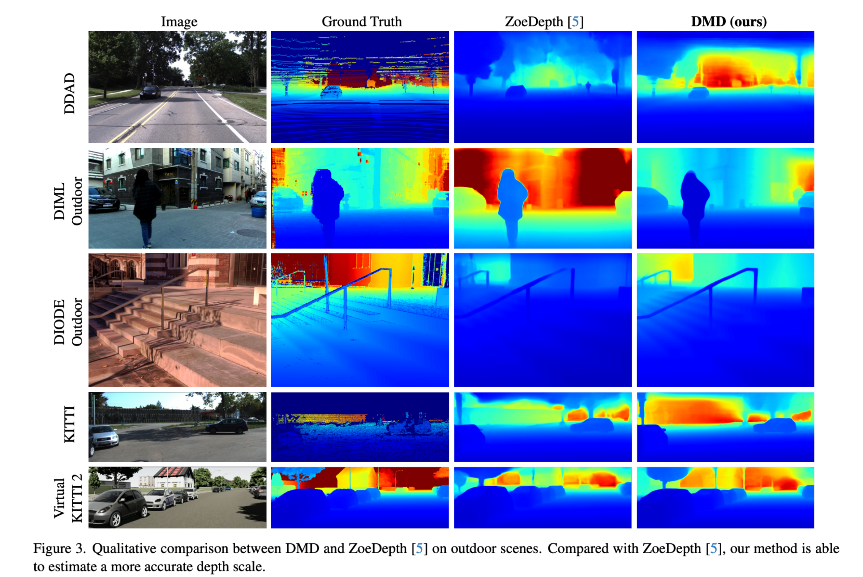
Sample from a comparative study published on MarktechPost and the original Paper from Saurabh Saxena on Arxiv
Epic Games and Reality Capture
Epic Games, known for its acquisition of

Sample from our Objet Témoin transmission lab project on digitizing legacy camera systems from past century (here Canon XL-1 core body system)
Risks of Geographic Data in Public Information
-
Leaking Sensitive Information
The inclusion of geographic data in public releases, like social media posts, can inadvertently expose high-value assets or strategic locations, posing
security risks -
Threat to Natural Resources
Revealing the
locations of endangered species or sensitive ecosystems -
Destruction of archeological evidence
following the same idea, revelation of heritage site coordinates may attract amateur investigators or treasure hunters uneducated to scientific methodology and layared ground investigation. Usually this is why the Urbex community do not reveal easily their shooting locations, and the archeologists are reluctant to open visits on digging sites.
The Future: Combining GIS and DAM Systems
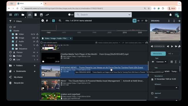
Mjoll Mimir Software suite for Television Networks including advanced geoloc. of video data for journalists
Benefits:
-
Cross-Platform Development: Integrating GIS with
Digital Assets Management systems -
AI-Assisted Governance and Automation: The future beckons the use of AI in geographical data governance. AI can
automate workflows
As we advance, the integration of geographic data in various industries highlights its undeniable value. However, with great power comes great responsibility. The blend of Geographic Information Systems and Digital Assets Management systems emerges as a critical solution. This integration, coupled with AI, will not only streamline data management but also ensure ethical and efficient use of geographic information. The future of geographic data is not just about technological advancement; it's about
Read more …Geographic Data is not just about SIG
- Hits: 819